

Avalanche Advisory
| Advisory: Uintas Area Mountains | Issued by Craig Gordon for March 3, 2013 - 6:11am |
|---|


Above treeline
Near treeline
Below treeline
|
bottom line A MODERATE avalanche danger is found at mid and upper elevations and human triggered avalanches are possible on steep wind drifted slopes. If you're looking for LOW avalanche danger, head to wind sheltered terrain or carve turns on flat meadows with no steep slopes above or adjacent to where you're riding.
|

 |
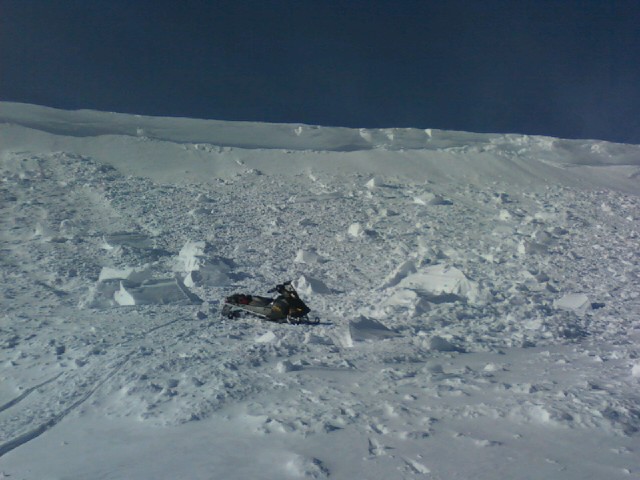
special announcement Our thoughts and prayers go out to the friends and family of James Childs, a 30 year old snowmobiler who was killed in an avalanche accident Friday in 12 Mile Canyon on the southern end of the Manti-Skyline. Our investigation of the accident is posted here. |
 |
current conditions A moist Pacific system on our door step this morning is ushering in thick clouds and temperatures in the upper 20's and low 30's. Southwest winds picked up around 5:00 yesterday and have been blowing steadily in the mid 20's and 30's. The surface snow took a big hit from yesterday's strong sunshine, but patches of soft settled powder will still be found on upper elevation north facing slopes. Recent observations can be found here. Our entire Uinta weather station network is up and running. A link to real-time wind, snow, and temperature data can be found here. This monumental achievement couldn't have happened without the joint efforts from the National Weather Service, The Heber-Kamas and Evanston Ranger Districts, Park City Powder Cats, and all the great work by Ted, Trent, Cody, and Al. Thanks to everyone... this is awesome!
Wondering why last winter was so crazy? Click here to watch the 2011-12 Utah Winter Review... an excellent recap of last years conditions.
|
 |
recent activity
This large piece of cornice on Tower Mountain broke under a sledder yesterday, but fortunately no one was crushed by the big blocks of snow.
Click here for recent observations from the region. |
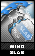
Avalanche Problem 1over the next 24 hours
| type | aspect/elevation | characteristics |
|---|
 |

Above treeline
Near treeline
Below treeline
|
|
|
description
Much of the snow available for transport got baked in place yesterday, but as the storm materializes the wind will have something to work with. Mostly manageable in size and depth, today's shallow soft slopes will break at or around your skis, board, or sled. As always, gather a little information by tweaking road cuts and small test slopes to see how they're reacting before you head into big committing terrain.
|

Avalanche Problem 2over the next 24 hours
| type | aspect/elevation | characteristics |
|---|
 |
Above treeline
Near treeline
Below treeline
|
|
|
description
Lots of people got into big terrain yesterday without incident and that's good news. However, looking at the structure of the snow many steep slopes remain suspect and I wouldn't bet my life on a set of tracks as a barometer of snow stability. Strong snow on weak snow... it's what the Uinta's are famous for. Unfortunately, it's also this combination that leads to tricky avalanche conditions. The strong snow allows us to get well out onto the slope before it fails and we trigger a deep, dangerous slide. A wild card in the deck is the possibility of triggering a slide mid slope or on your approach from the bottom. Best way to combat this condition is with terrain management. Tone down you're objectives a notch or two and consider the consequences of triggering a slide.
|

Avalanche Problem 3over the next 24 hours
| type | aspect/elevation | characteristics |
|---|
 |
Above treeline
Near treeline
Below treeline
|
|
|
description
Cornices have grown quite large and may break back further than you might expect.
|
 |
weather Snow should develop later this morning, with the heaviest band working its way into the region tonight. Looks like 3"-5" by Monday morning is a good bet. West and southwest winds continue to blow throughout the day in the 20's and 30's with an occasional gust in the 40's. Temperatures hover right around freezing before crashing into the teens as colder air arrives overnight. Clear and cold for Monday, warmer on Tuesday, and unsettled weather is on tap for the second half of the week.
|
| general annoucements Remember your information can save lives. If you see anything we should know about, please participate in the creation of our own community avalanche advisory by submitting snow and avalanche conditions. You can call me directly at 801-231-2170, email [email protected], or email by clicking HERE This is a great time of year to schedule a free avalanche awareness presentation for your group or club. You can contact me at 801-231-2170 or email [email protected] Donate to your favorite non-profit –The Friends of the Utah Avalanche Center. The UAC depends on contributions from users like you to support our work. The information in this advisory is from the US Forest Service which is solely responsible for its content. This advisory describes general avalanche conditions and local variations always occur. The information in this advisory expires 24 hours after the date and time posted, but will be updated by 7:00 AM Wednesday March 6th. |