

Avalanche Advisory
| Advisory: Uintas Area Mountains | Issued by Craig Gordon for January 31, 2013 - 5:29am |
|---|


Above treeline
Near treeline
Below treeline
|
bottom line At and above treeline a CONSIDERABLE avalanche danger exists today and deep, dangerous human triggered avalanches are likely. Within this terrain, pockets of HIGH avalanche danger is found, especially on steep wind drifted slopes with an easterly component to their aspect. A MODERATE avalanche danger is found on steep, wind drifted mid elevation terrain and human triggered avalanches are possible. LOW avalanche danger is found in terrain where there are no steep slopes above or adjacent to where you're riding .
|
 |
special avalanche bulletin Strong winds will continue overloading our preexisting snowpack, leading to dangerous avalanche conditions. Deep, dangerous human triggered avalanches are likely, especially on steep wind drifted slopes. |

 |
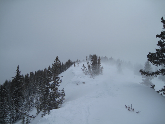
current conditions West winds continued to blow yesterday, averaging 30 mph with gusts in the 40's and 50's. At 4:00 this morning they just started decreasing into the high 30's. Looks like about 5" of new, high density snow has fallen in the past 24 hours. The downside are yesterday's warm temperatures which coated many slopes with a thin layer of rime. Temperatures are in the low 20's and riding conditions remain quite good on wind sheltered slopes and south facing terrain. Both Ted Scroggin and JG have been killin' it lately with solid Uinta info. Thanks guys for all the great trip reports this year. Recent observations can be found here. Wondering why last winter was so crazy? Click here to watch the 2011-12 Utah Winter Review... an excellent recap of last years conditions. |
 |
recent activity
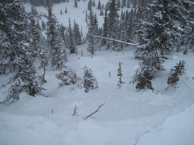
On Tuesday, Ted found shallow softs slabs along the leeward side of upper elevation ridges. Since two days ago these have grown thicker and more stubborn, breaking wider than you'd expect. An accident report detailing the very tragic avalanche in the West Fork of the Duchesne can be found here.
|
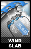
Avalanche Problem 1over the next 24 hours
| type | aspect/elevation | characteristics |
|---|
 |
Above treeline
Near treeline
Below treeline
|
|
|
description
5" of new dense snow in the past 24 hours added yet another load to our already reeling snowpack. Strong winds have made it challenging to tell exactly how much snow we've received since the beginning of the storm, but 12"-18" seems like a solid bet. The main issue however is the strong winds that have been blowing since Sunday afternoon when the initial front arrived. One thing is for sure, avalanche conditions are tricky and today’s slides can fail on weak, sugary snow now buried several feet deep. Once triggered, today's avalanches will be dangerous and will break deeper and wider than you might expect.. Low angle slopes not connected to steep slopes above you along with terrain facing the south half of the compass will be the ticket. With these great riding options available, you can avoid avalanches altogether and have a blast today.
Winds have been nuking along the ridges the past few days. Forming stiff slabs all over the place. |

Avalanche Problem 2over the next 24 hours
| type | aspect/elevation | characteristics |
|---|
 |


Above treeline
Near treeline
Below treeline
|
|
|
description
Fresh wind slabs are the most obvious avalanche problem today and they're bordering on unmanageable. Don't get tricked into thinking this is the only avalanche dragon out there. An easily triggered soft slab can quickly get out of hand, especially if it breaks into weaker layers of the snowpack as it crashes down on the slope below. |
 |
weather The moist northwest flow that's been over the region since the beginning of the week is starting to move east of the region. Skies remain cloudy and westerly winds obnoxious, gusting into the 40's along the high ridges. Temperatures climb into the upper 20's before dipping into the teens overnight under clearing skies. High pressure and warming temperatures with light wind is on tap for Friday through the weekend. |
| general annoucements Remember your information can save lives. If you see anything we should know about, please participate in the creation of our own community avalanche advisory by submitting snow and avalanche conditions. You can call me directly at 801-231-2170, email [email protected], or email by clicking HERE This is a great time of year to schedule a free avalanche awareness presentation for your group or club. You can contact me at 801-231-2170 or email [email protected] Donate to your favorite non-profit –The Friends of the Utah Avalanche Center. The UAC depends on contributions from users like you to support our work. The information in this advisory is from the US Forest Service which is solely responsible for its content. This advisory describes general avalanche conditions and local variations always occur. The information in this advisory expires 24 hours after the date and time posted, but will be updated by 7:00 AM Friday February 1st. |