

Avalanche Advisory
| Advisory: Provo Area Mountains | Issued by Evelyn Lees for March 6, 2013 - 6:57am |
|---|


Above 9,500 ft.
8,000-9,500 ft.
Below 8,000 ft.
|
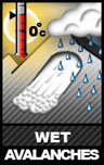
bottom line Avoid steep, wind drifted terrain at all elevations, where the avalanche danger is MODERATE, and human triggered avalanches possible. The avalanche danger is pushing CONSIDERABLE along the highest wind swept ridgelines, and natural cornice falls are possible. The avalanche danger is also MODERATE for heat related avalanches – wet sluffs and few wet slabs - as the snow heats. Glide avalanches could release.
|
 |
special announcement • Thursday night: a Free 'Know Before You Go' presentation will be held at the Black Diamond Store at 7pm.
|
 |
current conditions Under partly cloudy skies, it’s warm and windy. The southerly winds are averaging 15 to 25 mph, with gusts to 40, with the high ridgelines cranking at 40 to 50 mph, with gusts to 60. Temperatures are in the twenties to low 30s. Highest average wind speeds and overall warmest temperatures (mid 30s to low 40s) are in the Ogden area mountains. |
 |
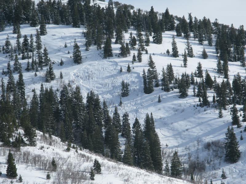
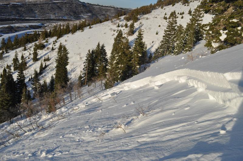
recent activity • Yesterday’s eye catcher was an unintentionally triggered soft slab on a northwest facing slope at 7,500’ near Parley's summit, that was 175' wide by 2.5' deep, running into a terrain trap of a gully. It failed on facets in a shallow snow pack area (44 inches). Great observation HERE. Parley's slide:
|
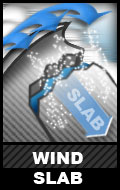
Avalanche Problem 1over the next 12 hours
| type | aspect/elevation | characteristics |
|---|
 |
Above 9,500 ft.
8,000-9,500 ft.
Below 8,000 ft.
|
|
|
description
Strong southerly winds overnight and today will continue to find snow to drift, especially onto northerly facing slopes along the highest ridgelines. Where speeds are fastest, drifting will also occur into the mid elevations. Mid slopes deposits will be at slope break overs, along gully walls, and around sub ridges. Also avoid the older drifts on easterly facing slopes from the past westerly winds. Cornices are becoming large and sensitive, and generally break back further than expected. |

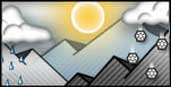
Avalanche Problem 2over the next 10 hours
| type | aspect/elevation | characteristics |
|---|
 |
Above 9,500 ft.
8,000-9,500 ft.
Below 8,000 ft.
|
|
|
description
Spring temperatures are here, but the snowpack still adjusting to the warming. The effects of the sun are now felt around the compass, and as each slope warms, especially for the first time, the snow becomes sensitive. The Parley’s slide could have been a combination of wind drifting and heating.
|
 |
weather Another warm and windy day is in store as complex Pacific storm along the west coast prepares to move inland in pieces. Temperatures today will warm into the low 40s at 8,000’ and remain in the mid-20s at 10,000’. The southerly winds will be strongest this morning, averaging 15 to 25 mph, with gusts in the 30s. The highest terrain will have averages around 35 mph, with gusts to 60 mph. The cold front will move into the state tonight, stall over northern Utah, and be the focus of the heaviest precipitation. The exact local is unknown, but expected to be north of I-80. Then periods of snow through Saturday night as the low pressure system moves in land, tracking across the Utah/Arizona border. |
| general annoucements Go to http://www.backcountry.com/utah-avalanche-center to get tickets from our partners at Beaver Mountain, Canyons, Sundance, and Wolf Mountain. All proceeds benefit the Utah Avalanche Center. If you trigger an avalanche in the backcountry - especially if you are adjacent to a ski area – please call the following teams to alert them to the slide and whether anyone is missing or not. Rescue teams can be exposed to significant hazard when responding to avalanches, and do not want to do so when unneeded. Thanks. Salt Lake and Park City – Alta Central (801-742-2033), Canyons Resort Dispatch (435-615-3322) Ogden – Snowbasin Patrol Dispatch (801-620-1017) Powder Mountain Ski Patrol Dispatch (801-745-3772 ex 123) Provo – Sundance Patrol Dispatch (801-223-4150) Dawn Patrol Forecast Hotline, updated by 05:30: 888-999-4019 option 8. Twitter Updates for your mobile phone - DETAILS Daily observations are frequently posted by 10 pm each evening. Subscribe to the daily avalanche advisory e-mail click HERE. UDOT canyon closures UDOT at (801) 975-4838 Wasatch Powderbird Guides does daily updates about where they'll be operating on this blog http://powderbird.blogspot.com/ . Remember your information can save lives. If you see anything we should know about, please participate in the creation of our own community avalanche advisory by submitting snow and avalanche conditions. You can also call us at 801-524-5304 or 800-662-4140, email by clicking HERE, or include #utavy in your tweet. Donate to your favorite non-profit –The Friends of the Utah Avalanche Center. The UAC depends on contributions from users like you to support our work. For a print version of this advisory click HERE. This advisory is produced by the U.S. Forest Service, which is solely responsible for its content. It describes only general avalanche conditions and local variations always exist. Specific terrain and route finding decisions should always be based on skills learned in a field-based avalanche class. |