Home
utahavalanchecenter.org
Keeping you on top!

Sponsor Ads

  • About
    • Submit Avalanche Observations
    • Contact
    • Who we are
    • Staff
    • FUAC
    • How we generate an advisory
    • Log in
  • Advisories
    • Logan
    • Ogden
    • Salt Lake
    • Provo
    • Uintas
    • Skyline
    • Moab
    • Tomorrow's Danger Rating
    • Podcasts
    • Archives
  • Education
    • Classes/Workshops
    • Know Before You Go
    • Tutorials
    • Beacon Practice
    • Avalanche Stats
    • FAQ
    • Encyclopedia
  • Detailed Info
    • Submit Backcountry Observations
    • All the Good Stuff
      • All Regions
      • Logan
      • Ogden
      • Salt Lake
      • Provo
      • Uintas
      • Skyline
      • Moab
    • Avalanches
      • All Regions
      • Logan
      • Ogden
      • Salt Lake
      • Provo
      • Skyline
      • Uintas
      • Moab
      • Detailed List
    • Accidents
    • Video
    • Photos
      • Avalanches
    • Maps
      • Selected Routes
      • Place Names Map
    • Archives
  • Blog
  • Weather
    • Mtn Weather Forecasts
      • Logan
      • Moab
      • Salt Lake
    • 48hr Weather Charts
      • Temps-Wind-Precip
      • Precipitation
    • Seasonal Weather Charts
      • Current Season
      • Alta Monthly Snowfall
      • Archives
    • Radar Loops
      • Salt Lake Regional
      • US Composite
  • Resources
    • Essential Gear
    • Smartphone Apps
    • Beacon Tech
    • Beacon Practice
    • Books & Videos
    • Guide Services
    • Wasatch Backcountry Rescue
    • Local Mtn Info
    • Place Names Map
  • Events
    • List View
    • Calendar View
      • September
      • October
      • November
      • December
      • January
      • February
      • March
      • April
  • Store
    • Online Store
    • Online Store Help
  • Sponsors
  • Donate
Avalanche Advisory
Tweet
Advisory: Provo Area Mountains Issued by Evelyn Lees for February 13, 2013 - 6:36am
Above 9,500 ft.
8,000-9,500 ft.
Below 8,000 ft.
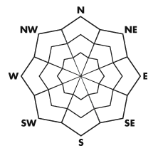
bottom line

The avalanche danger is MODERATE for triggering a wind drift or wind slab, which are most widespread along the higher ridgelines, on south through east through northeast facing slopes. The avalanche danger is also MODERATE for triggering loose snow sluffs, having a cornice break off and for the isolated chance of triggering a 1 to 3 foot deep slab avalanche on a northerly facing slope.


danger scale: 1. Low 2. Moderate 3. Considerable 4. High 5. Extreme
special announcement

Drew will be leading the fireside chat at the Black Diamond retail store tomorrow night , Thursday the 14th, at 730 pm, covering current thoughts on the snowpack and various other topics.

current conditions

Under cloudy skies this morning’s temperatures are a bit warmer – mostly in the teens. The northwesterly winds have calmed down temporarily, and all but a few stations are averaging less than 10 mph this morning. Somewhere around midnight, a trace to an inch of snow fell, adding to the fluff on the shady slopes.

recent activity

There were a couple of human triggered wind slabs yesterday on the Little Superior/Superior ridge line, with everyone avoiding taking a ride. The largest was 1-2 feet deep and 50’ wide, running over 300’. There was also an out of bounds skier triggered wind slab in Limelight on the Park City side. The resorts reported releasing both sluffs and soft winds slabs with ski cuts, and the new cornices were sensitive.

Avalanche Problem 1over the next 24 hours
type aspect/elevation characteristics
Above 9,500 ft.
8,000-9,500 ft.
Below 8,000 ft.
likelihood size
likely
unlikely
large
small
distribution trend
widespread
isolated
More Dangerous
Increasing
Less Dangerous
description

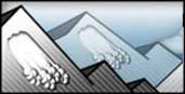
The winds are forecast to increase again today – from a slightly more westerly direction, so there will be a slightly different loading pattern. Avoid all wind drifts on steep slopes - yesterday’s slightly harder and more stubborn drifts and today’s new softer wind drifts. While most widespread along the ridges, drifts can also be found off the ridgelines, cross loaded around sub ridges, gully walls and mid slope break overs. They are large enough to catch and carry an unaware person. Think about where you could be carried, avoiding travel in wind drifted terrain above unforgiving features such as gullies, cliffs or trees.

Cornices go hand in hand with wind, and are sensitive, tending to break back further than expected.

Avalanche Problem 2over the next 24 hours

type aspect/elevation characteristics
Above 9,500 ft.
8,000-9,500 ft.
Below 8,000 ft.
likelihood size
likely
unlikely
large
small
distribution trend
widespread
isolated
More Dangerous
Same
Less Dangerous
description
  • Dry sluffs – continue to be easy to trigger on steep slopes, including the low elevation shady slopes, and are large enough to carry a person in continuously steep terrain.
  • Persistent slab – The January weakness of facets, buried 1 to 3 feet deep on northwest though north through easterly facing steep slopes, could still be triggered by a person or by the weight of a smaller slide in isolated places (a “step down”). Collapsing noises and a “punchy” snow pack are indications of the layering.
weather

Weak disturbances in a northerly flow will keep skies mostly cloudy, with occasional light snow possible. A short period of riming is possible today, in the early afternoon. Temperatures will warm into the upper 20s at 8000’ and the upper teens at 10,000’. The winds will shift a little more westerly and will increase into the 20 to 30 mph range across the highest ridgelines, with gusts to 40. Elsewhere, 5 to 15 mph averages will be more common.

A weak disturbance overnight could produce 3 to 5” of snow by morning, with locally higher amounts to the north near Logan. The high pressure ridge will move overhead for the weekend, bring mostly clear skies. The models give some hope for a decent storm around the middle of next week.

general annoucements

Go to http://www.backcountry.com/utah-avalanche-center to get tickets from our partners at Park City, Beaver Mountain, Canyons, Sundance, and Wolf Mountain. All proceeds benefit the Utah Avalanche Center.

If you trigger an avalanche in the backcountry - especially if you are adjacent to a ski area – please call the following teams to alert them to the slide and whether anyone is missing or not. Rescue teams can be exposed to significant hazard when responding to avalanches, and do not want to do so when unneeded. Thanks.

Salt Lake and Park City – Alta Central (801-742-2033), Canyons Resort Dispatch (435-615-3322)

Ogden – Snowbasin Patrol Dispatch (801-620-1017)

Powder Mountain Ski Patrol Dispatch (801-745-3773 ex 123)

Provo – Sundance Patrol Dispatch (801-223-4150)

Dawn Patrol Forecast Hotline, updated by 05:30: 888-999-4019 option 8.

Twitter Updates for your mobile phone - DETAILS

Daily observations are frequently posted by 10 pm each evening.

Subscribe to the daily avalanche advisory e-mail click HERE.

UDOT canyon closures UDOT at (801) 975-4838

Wasatch Powderbird Guides does daily updates about where they'll be operating on this blog http://powderbird.blogspot.com/ .

Remember your information can save lives. If you see anything we should know about, please participate in the creation of our own community avalanche advisory by submitting snow and avalanche conditions. You can also call us at 801-524-5304 or 800-662-4140, or email by clicking HERE

Donate to your favorite non-profit –The Friends of the Utah Avalanche Center. The UAC depends on contributions from users like you to support our work.

For a print version of this advisory click HERE.

This advisory is produced by the U.S. Forest Service, which is solely responsible for its content. It describes only general avalanche conditions and local variations always exist. Specific terrain and route finding decisions should always be based on skills learned in a field-based avalanche class.

Tweet

2242 West North Temple | Salt Lake City, UT 84116 | (801) 524-5304 | Advisory Hotline: (888) 999-4019 | Contact

Powered by Drupal