

Avalanche Advisory
| Advisory: Ogden Area Mountains | Issued by Bruce Tremper for November 26, 2012 - 5:37am |
|---|


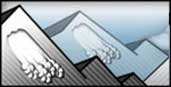
Above 8,500 ft.
7,000-8,500 ft.
Below 7,000 ft.
|
bottom line Mostly stable snow in all areas. Places where you still may find an avalanche would include some isolated wind slabs along the upper elevation ridges or perhaps some pockets in extreme terrain.
|

 |
current conditions Yep, we're trapped in the doldrums for a few more days--waiting for snow. But there's hope on the horizon in the extended forecast...wait for it....read the weather forecast below. In the mean time, we have old, worn out snow, icy at lower elevations, crusty on most places, wind slabs at upper elevations, and yes, there's still some patches of soft, dry, recrystalized snow on mid and upper elevation, wind sheltered, north facing slopes. And today should be yet another great day to get up above the smog into the mountains and into the sun. |
 |
recent activity No avalanche activity reported in the past two weeks. |
Avalanche Problem 1over the next 24 hours
| type | aspect/elevation | characteristics |
|---|
 |
Above 8,500 ft.
7,000-8,500 ft.
Below 7,000 ft.
|
|
|
description
There continues to be a Low avalanche danger in all areas. (Thus no areas colored blue in the aspect-elevation rose in the Basic View.) Of course, Low danger never means no danger so the places where you may still find an avalanche would be an isolated wind slab along the upper elevation ridges or in upper elevation, extreme terrain. Unfortunately, clear weather creates weak layers. With no snow for the past couple weeks, the snow is rotting away into sugar snow on the northerly facing slopes, especially at mid elevation, wind sheltered slopes. In other words, things will get very exciting the next time the weak snowpack is loaded up with the weight of the next major snowstorm. Which could occur this coming weekend.... |

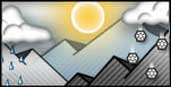 |
weather Today we should have light winds, clear to partly cloudy skies, highs in the 30's and lows in the mid teens. We will have a warming trend for the next couple days. The extended forecast calls for a change in the weather by the weekend with the possibility of more significant snow. Southwest ridge top winds should increase by Thursday and Friday with a chance of precipitation but it looks like we may have to wait until later in the weekend for more significant snow--probably until Monday. Yes, there is hope on the horizon. |
| general annoucements If you trigger an avalanche in the backcountry - especially if you are adjacent to a ski area – please call the following teams to alert them to the slide and whether anyone is missing or not. Rescue teams can be exposed to significant hazard when responding to avalanches, and do not want to do so when unneeded. Thanks. Salt Lake and Park City – Alta Central (801-742-2033) Ogden – Snowbasin Patrol Dispatch (801-620-1017) Provo – Sundance Patrol Dispatch (801-223-4150) Dawn Patrol Forecast Hotline, updated by 05:30: 888-999-4019 option 8. Twitter Updates for your mobile phone Daily observations are frequently posted by 10 pm each evening. Subscribe to the daily avalanche advisory e-mail click HERE. UDOT canyon closures UDOT at (801) 975-4838 Wasatch Powderbird Guides does daily updates about where they'll be operating on this blog http://powderbird.blogspot.com/ . Remember your information can save lives. If you see anything we should know about, please participate in the creation of our own community avalanche advisory by submitting snow and avalanche conditions. You can also call us at 801-524-5304 or 800-662-4140, or email by clicking HERE Donate to your favorite non-profit –The Friends of the Utah Avalanche Center. The UAC depends on contributions from users like you to support our work. This advisory is produced by the U.S. Forest Service, which is solely responsible for its content. It describes only general avalanche conditions and local variations always exist. Specific terrain and route finding decisions should always be based on skills and procedures learned in a field-based avalanche class. Bruce will update this forecast tomorrow. Thanks for calling. |