

Avalanche Advisory
| Advisory: Moab Area Mountains | Issued by Max Forgensi for February 11, 2013 - 6:58am |
|---|


 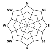
Above treeline
Near treeline
Below treeline
|
bottom line The Bottom Line for today will be an Avalanche Danger of Considerable for any new soft wind slabs which has developed on leeward sides of slopes and ridges in the La Sal and Abajo mountain ranges on steep slopes greater than 35 degrees. Please check back Tuesday morning for more details defining the avalanche problem's we face in the mountains mid-February.
|
 |
current conditions Winter continues to affect both the mountains and canyons of southeast Utah. As of 6:00 am, 4 inches of snow has fallen in Moab while storm totals in the Abajo and La Sal Mountains hover around 12 inches. 14" (35 cm) of snow was cleared from the Gold Basin Study Plot yesterday afternoon with a total of 56" (140 cm) on the ground at 10,000'. Both Camp Jackson and the Geyser Pass Winter TH hold around 40" of snow on the ground. This weekend's breathless days of snow falling straight out of the sky are over. Pre-Laurel Peak has received some moderate winds blowing out of the south through southeast for a 10 hour period...these 10 to 15 mph winds has definitely moved some snow around . Wind and snow will make travel to the trailhead's require 4WD and chains. LUNA volunteers will be up (if they are not already) to start and reestablish some corduroy. For those heading out this week, go to our Mountain Weather Page to NOWCAST current weather conditions and snow totals. |
 |
recent activity There has been reports trickling in of some small avalanches in the Miner's Basin area. I would expect any new soft wind slabs to be sensitive to a traveler's weight. If you do see an avalanche, please give us an observation, the form can be found under the DETAILED INFO drop down menu at utahavalanchecenter.org.
|
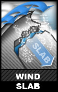
Avalanche Problem 1over the next 24 hours
| type | aspect/elevation | characteristics |
|---|
 |


Above treeline
Near treeline
Below treeline
|
|
|
description
Wind continues to actively transport snow from southerly fetch areas and deposit them onto their northerly counterparts. Cross loading will definitely be a concern above treeline. Until the wind dies down, natural avalanches will be likely, and human triggered avalanches probable at least for the next 24 hours. |

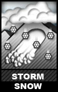
Avalanche Problem 2over the next 24 hours
| type | aspect/elevation | characteristics |
|---|
 |


Above treeline
Near treeline
Below treeline
|
|
|
description
Storm snow has been very light density...I am estimating around 5%. Although these avalanches may be more loose snow avalanches, I am placing them under the new snow avalanche problem considering a field day is in order today to better define the avalanche problem for everyone. |

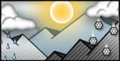 |
weather Today: Snow showers, mainly before 4pm. High near 18. Northwest wind 5 to 10 mph. Chance of precipitation is 80%. Total daytime snow accumulation of 3 to 5 inches possible. |
| general annoucements The Friends of the La Sal Avalanche Center are an important partner to the Utah Avalanche Center-Moab. They assist by providing field observers, maintaining weather stations and purchase weather and safety equipment. Go to our partners website at www.moabavalanche.org to donate today. The Utah Avalanche Center-Moab is on Facebook! Get update and advisories by becoming a friend today. |