Join us at our 2nd Annual Blizzard Ball

Observation: Guardsman Pass area

Observation Date
1/3/2025
Observer Name
Bruce Tremper
Region
Salt Lake » Big Cottonwood Canyon » Guardsman Pass area
Location Name or Route
Peak 10,420 and Scott's Hill
Weather
Sky
Scattered
Wind Direction
South
Wind Speed
Strong
Weather Comments
Very stout, southerly wind from approaching storm starting tomorrow morning.
Snow Characteristics
Snow Surface Conditions
Dense Loose
Wind Crust
Melt-Freeze Crust
Snow Characteristics Comments
With the very strong winds from the south blowing in advance of tomorrow morning's cold front, it was transporting what little snow remained on the southerly aspects onto the northerly-facing slopes. There was still soft, dense, surfy powder on the northerly, wind-sheltered aspects and sun crusts on the sun-exposed aspects.
Red Flags
Red Flags
Wind Loading
Cracking
Red Flags Comments
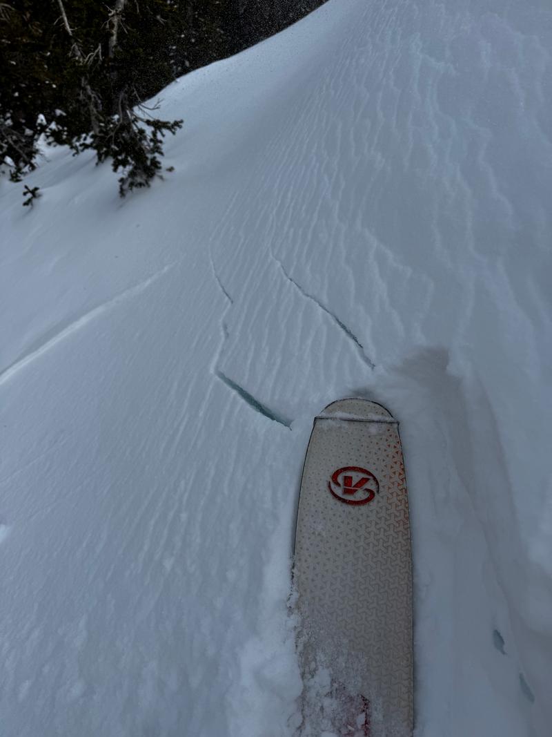
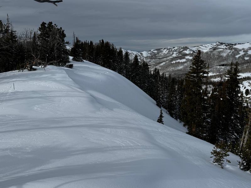
The strong, winds from the south were stripping all the snow off of the wind-exposed, south-facing aspects and creating stiff, stubborn, wind slabs on northerly aspects. There was not a lot of snow available for transport but it was still quickly blowing over previous tracks and making stiff wind slabs. I could get some cracking on stubborn wind slabs, but I was obviously avoiding steep slopes with recent wind drifts where the cracks would probably be much longer or avalanche. Tomorrow's storm will conceal all the wind slabs from today, so your only choice will be to choose conservative terrain.
Avalanche Problem #1
Problem
Wind Drifted Snow
Avalanche Problem #2
Problem
Persistent Weak Layer
Problem #2 Comments
Monsters in the basement still exist on many slopes. With new snow, it's always tempting to jump into steeper terrain because the snow underneath feels solid. My Alaska avalanche mentor, Doug Fesler, used to call it "sucker snow."
Snow Profile
Aspect
West
Elevation
9,400'
Slope Angle
25°
Comments
Photo 1: Strong wind was transporting snow and creating stiff, stubborn wind slabs on nownwind terrain, mostly north facing terrain.
Photo 2: Stout wind slab would crack but were stubborn
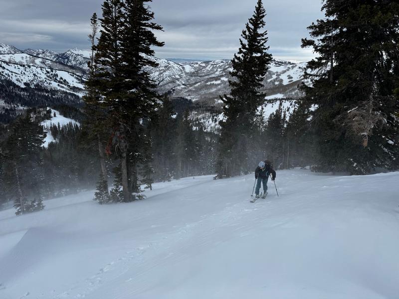
Photo 3 I was surprised to see fresh tracks descending this slope along with a climbing trail. The slope did not avalanche but it was exactly the kind of slope that that has been avalanching these past few days, steep, north facing, recently wind loaded.
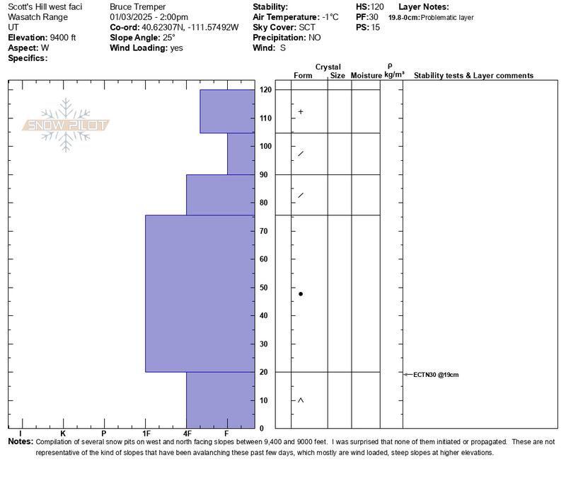
Snow profie: This is a compilation of three different snow profiles I dug, two on west facing slopes near Scott's Hill and one on a north facing slope near Guardsman's Pass trailhead in the meadow by the creek. I was very surprised that I was not able to initiate nor propagate a collapse on the basal depth hoar near the ground. A couple weeks ago, the snow would easily collapse and propagate on the depth hoar. The snowpack is getting deeper with a stronger, stouter slab on top and the depth hoar layer has gained a lot of strength. Obviously, these snow profiles are not representative of the many avalanches we have seen these past few days with the big storm. Most of the avalanches were on upper elevation, steep, recently wind loaded slopes. All my profiles were in wind sheltered areas and on gentler slopes.
Today's Observed Danger Rating
Considerable
Tomorrows Estimated Danger Rating
Considerable
Coordinates
Snow Pilot URL