Observer Name
Gill and Coyne
Observation Date
Monday, January 3, 2022
Avalanche Date
Monday, January 3, 2022
Region
Provo » Provo Canyon » Timpanogos » Wooley Hole
Location Name or Route
Mt Timpanogos, Woolly Hole
Elevation
8,900'
Aspect
North
Trigger
Skier
Depth
12"
Width
50'
Comments
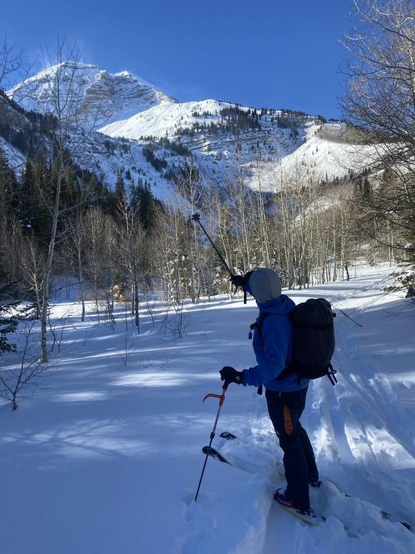
Went up to assess the large avalanches that occurred last week in Woolly Hole and Pika Cirque, and possibly get a crown profile from Woolly. Plan was to ascend the debris pile and avy path, avoiding the hanging snowfield to the west, which had not slid as everything else had during the past storm. We were hoping to ski a few inches of recycled, wind deposited pow on the bed surface that had slid on the PWL the in the days prior.
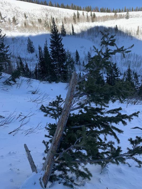
We saw evidence of apocalyptic slides on the persistent weak layer in both Woolly Hole and Pika Cirque that had run full track to the flats near the campground. There were new, broken trees 6-8” in diameter scattered about the deposition zone. Based on the debris it appears enormous soft slabs had run to the flats, and we estimated crowns to be 6-8 feet deep.
We noticed significant wind transport and spindrift on the bench above and especially the high ridges as we ascended the lower headwall, as well as two avalanches in new and wind deposited snow that released from the north facing, hanging snowfield west of our ascent route as we traveled uphill. In places where the terrain turned east we found 1” dinner plate wind slabs that would crack on top of the bed surface but weren’t deep or cohesive enough to run.
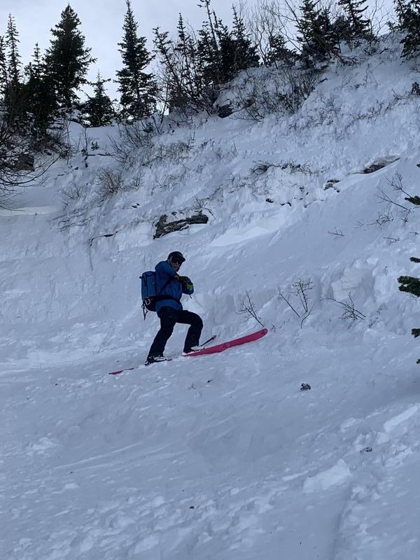
We switched to bootpacking for the final 150 feet towards the bench beneath Woolly hole, kicking steps 1-2” into firm, scoured snow on the flank of the shallow couloir. Then I kicked a step that was hollow up to my knee and released a 12-15” deep wind slab that broke 50-60’ above us and about 50’ wide. It only ran 100-200’ before stopping and neither of us were carried. Terrain was north facing just shy of 9,000 feet, 40-45 degrees where the isolated wind slab was.
With that bright red flag and increasing wind transport above we decided to call it a day and skied down nice, recycled north facing powder back to the campground and the car. We should have anticipated more irregular wind loading with the levels of transport we were seeing and been a bit more vigilant about pockety, isolated wind slabs even in the absence of PWL hazard due to the recent large slides.
With a substantial storm on the horizon we should assume the PWL will become active again as a slab builds on top of the faceted snow on the be surface. Increasing winds ahead of the front will also heighten wind slab danger in a thin, rocky snowpack.


Coordinates


