

Forecast for the Abajos Area Mountains

Issued by Eric Trenbeath on
Saturday morning, January 23, 2021
Saturday morning, January 23, 2021
New and wind drifted snow has elevated the avalanche danger to CONSIDERABLE on steep, upper elevation slopes that face NW-N-E and human triggered avalanches are likely in these areas. The underlying snowpack is comprised of weak, sugary, faceted snow, and triggered wind drifts will likely step down into these layers causing a deeper and more dangerous avalanche. At mid and lower elevations the avalanche danger is MODERATE. Most south-facing terrain has LOW danger.
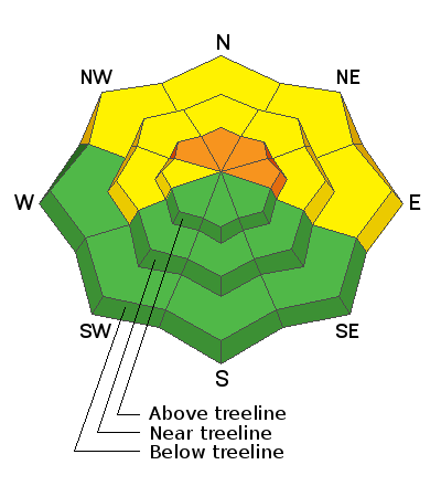
Low
Moderate
Considerable
High
Extreme
Learn how to read the forecast here