

Observer Name
feinberg
Observation Date
Monday, March 2, 2020
Avalanche Date
Monday, March 2, 2020
Region
Salt Lake » Big Cottonwood Canyon » Days Fork
Location Name or Route
East aspect of Reed and Benson Ridge (alta->flagstaff->Days->Big Cottonwood)
Elevation
10,200'
Aspect
East
Slope Angle
37°
Trigger
Skier
Trigger: additional info
Unintentionally Triggered
Avalanche Type
Wet Loose
Avalanche Problem
Wet Snow
Weak Layer
New Snow
Depth
5"
Width
40'
Vertical
450'
Comments
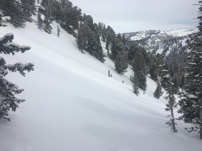
We came across this debris pile and slide ~12:30 today as we were ascending the SE rib of Reed and Benson. Definitely appeared that it occurred this morning as a result of a skier's first turn on the steeper convexity into this east facing gully feature. Skier's tracks continued down to the right of the slide path, and skier likely out-ran this quite easily. Started as a small point release, but quickly spread out to about 40' wide encompassing all ~5" of the new snow running on the old surface crust. R2D2 in size, big enough to potentially bury someone if they were unlucky (photos don't quite do it justice). When we reached the top of this slope, side slipping next to the slide didn't result in any further sloughing, as clouds had moved in and the slope wasn't receiving the direct sunlight it had during the clear blue skies earlier in the morning, and the surface had started to refreeze slightly.

Comments
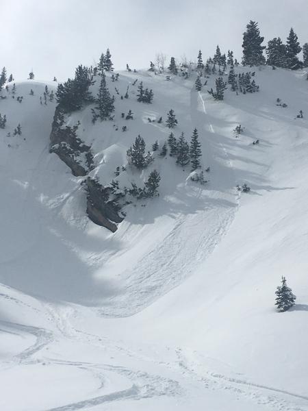
Experienced quite a bit of minor loose-dry sloughs throughout the tour today on steeper rolls of shady aspects, which were easily outrun by keeping speed up, but could have been enough snow to take me off my feet if turns were hesitant. Saw some natural loose dry sloughs up to D1 in size on shady northerly aspects triggered by snow falling off tree branches warmed from sun exposure (see photo), and some small minor wet point releases/rollerballs on SW aspects at lower elevations in the afternoon.
Cool air temps today, with light NW breeze at ridgetops in the early afternoon (not moving snow) diminishing to almost calm in the later afternoon. Highest ridges near Alta did have some visible snow transport in the morning. Blue skies and sunshine in the morning gave way to a period of clouds from ~noon to 2, then clouds became scattered with sunshine again in the later afternoon.
Mostly nice fun turns in the new snow despite the "bottom feeding" as ya'll call it out here :-) Even some areas of bottomless ones at mid elevation in sheltered trees where no crust existed between the new snow and underlying facets.
Coordinates