Donate to Our Spring Campaign or Bid on our Spring Auction to Support Forecasting

Forecast for the Logan Area Mountains

Toby Weed
Issued by Toby Weed on
Tuesday morning, March 9, 2021
Heightened avalanche conditions exist and there is MODERATE danger on steep upper and mid elevation slopes in the backcountry. Although becoming more unlikely, people could trigger large avalanches failing 2 to 3 feet deep on a deeply buried persistent weak layer in some areas. Shallow soft slab avalanches of drifted storm snow and loose avalanches or sluffs are possible on steep slopes in areas that picked up several inches of new snow overnight.
  • Evaluate snow and terrain carefully.
Low
Moderate
Considerable
High
Extreme
Learn how to read the forecast here
Special Announcements
Allen Foss of Preston, ID was killed in an avalanche Saturday, February 20, near Sherman Peak. Please consider supporting the Foss family during this difficult time.
Weather and Snow
It's a cool 21°F this morning at the 8400' Tony Grove Snotel, and there is two inches of new snow, with 68 inches of total snow and 85% of normal SWE. Northwest winds are currently blowing 15 mph at the CSI Logan Peak weather station, and temperatures at 9700' have dropped to 14°F. We're expecting a good chance of continuing snow showers today, moderate west-northwest winds winds, and temperatures at 8500' will top out at around 25°F. There's a chance of another inch or two of snow tonight, with a possibility of snow showers, clouds, and continued cooler temperatures tomorrow.
Recent Avalanches
A very extensive natural avalanche cycle occurred in mid February and evidence is still apparent across the zone including deep crown lines, large chunks and very long piles of avalanche debris.

A rider remotely triggered an avalanche on a drifted slope somewhere in the Elk Valley Area last Sunday (2-28-2021). A video of the avalanche was posted on Twitter HERE.
We've observed several recent natural long running wet loose avalanches on south, southeast, and southwest facing slopes in the zone in the past few warm days.
Ad
Avalanche Problem #1
Persistent Weak Layer
Type
Location
Likelihood
Size
Description
Although it is gradually becoming more unlikely for people to trigger avalanches, any potential avalanches could still be large and very dangerous. Buried persistent weak layers consisting of sugary faceted snow are widespread across the Logan Zone, and the threat of large avalanches failing on weak snow near the ground remains. Although suspect weak layers appear to be dormant in many areas, the sugary faceted snow near the ground is still dry, and it is likely to continue to be devious. People might trigger a large deep slab avalanche from a thinner part of the slab. As avalanches become less likely, they will remain possible for people to trigger on very steep slopes, in rocky terrain, and on slopes with generally thin snow cover.
  • Avalanches failing on a buried persistent weak layer might be triggered remotely, from a distance, or worse from below!
  • Cracking and collapsing of the snow are a red flag, indicating unstable snow conditions.
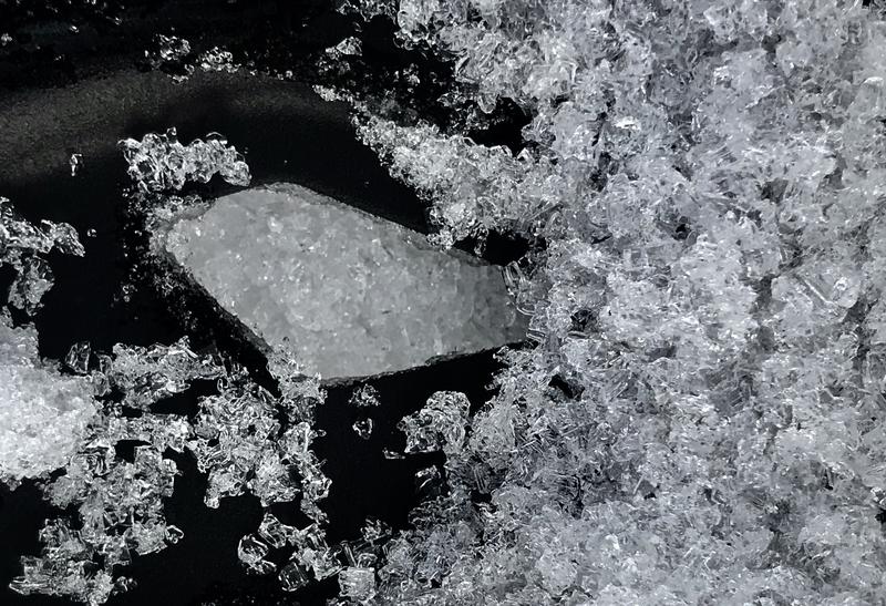
Faceted snow and even depth hoar like this is widespread across the Logan Zone, and it exists on slopes facing every direction and at all elevations... Maybe it's dormant, but I'm not planning to test my luck in steep terrain anytime soon..
The snow is still very weak, sugary or faceted, and dry. Even so, our tests show pretty good stability in most areas.
Avalanche Problem #2
New Snow
Type
Location
Likelihood
Size
Description
Small loose avalanches or sluffs and soft slabs of drifted new snow are possible in steep terrain. Some parts of the Logan Zone picked up around 6 inches of new snow overnight, and it is still snowing this morning. A slick sun-crust exists on sunny slopes and the new snow may not stick to it so well and loose avalanches are certainly possible. Moderate winds from the northwest are enough to drift the fresh snow at upper elevations and people might easily trigger small avalanches of fresh wind drifted snow on steep slopes.
  • Even a small avalanche can be dangerous if you get dragged into trees or other terrain traps below.
  • On some slopes with existing poor snow structure, a small avalanche of new snow might step down into old snow and cause a much more dangerous avalanche failing on our deeply buried persistent weak layer.
Additional Information
Do you have the essential avalanche rescue gear (transceiver, probe, and shovel) and do you know how to use them? Watch this video to see how the three pieces of equipment work together. HERE
Please keep practicing with the Beacon Training Park at the Franklin Basin Trailhead. Test yourself and your riding partners. It is free, fun, and easy to use.
General Announcements
Visit this website with information about Responsible Winter Recreation by the Utah Office of Outdoor Recreation.
EMAIL ADVISORY. If you would like to get the daily advisory by email you subscribe HERE.
Remember your information can save lives. If you see anything we should know about, please help us out by submitting snow and avalanche observations....HERE. You can also call us at 801-524-5304, email by clicking HERE, or include #utavy in your Instagram, or @UAClogan on Twitter.
I will update this forecast by around 7:30 Wednesday morning.
This forecast is from the USDA Forest Service, which is solely responsible for its content. The forecast describes general avalanche conditions and local variations always occur.