Donate to Our Spring Campaign or Bid on our Spring Auction to Support Forecasting

Forecast for the Abajos Area Mountains

Eric Trenbeath
Issued by Eric Trenbeath on
Sunday morning, March 22, 2020
The avalanche danger is MODERATE on steep, upper elevation slopes that face NW-N-E where human triggered avalanches involving wind drifted snow are possible. On isolated slopes in these same areas, human triggered avalanches failing on a buried persistent weak layer of loose, sugary, faceted snow are also possible. With the sun making its first real appearance today look for a rising MODERATE danger for loose, wet avalanches on sun-exposed slopes. Be on the lookout for signs of instability such as rollerballs and pinwheels and stay off of, and out from under steep slopes if they become wet and sloppy.
Low
Moderate
Considerable
High
Extreme
Learn how to read the forecast here
Special Announcements
We know there is a lot of uncertainty regarding the Coronavirus, but the Utah Avalanche Center is planning to continue issuing regular avalanche forecasts into April.
Weather and Snow
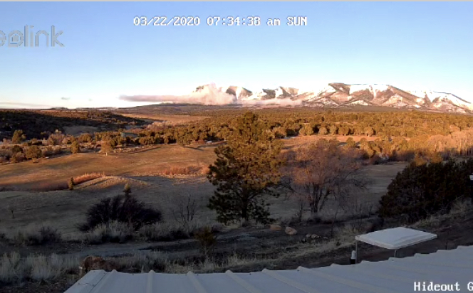
A beautiful morning! Webcam photo courtesy of Kevin Dressel.
Clouds are dissipating and we should see mostly sunny skies today. Westerly winds should be mostly light and high temps will be in the low to mid 30's. The next system will move into the region tomorrow with snow likely in the afternoon. It doesn't look like a big producer with 2"-4" possible. Of note, however, will be an increase in SW winds. Tuesday and Wednesday look dry with the next system
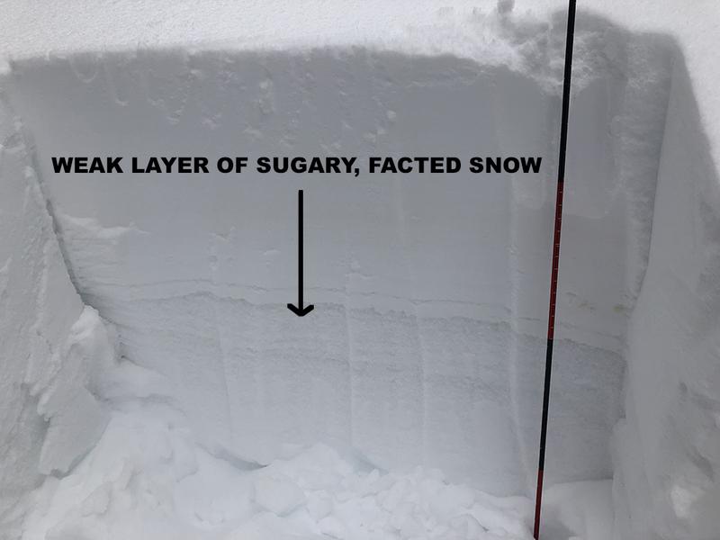
Conditions are vastly improved with 10"-16" of new snow falling since Wednesday. Clouds and cool temps have kept the snow mostly dry but it will get damp today. Southerly winds have blown and drifted snow on to upper elevation northerly facing slopes and unstable wind slabs in these areas are your primary concern today. Underneath, a layer of weak, sugary, faceted snow exists that may be problematic after the most recent snow load. In isolated areas, a triggered wind drift could step down to this buried weak layer causing a deeper and more dangerous avalanche.
Kevin Dressel photo.
Snow totals at Buckboard Flat (8924')
Snow totals at Camp Jackson (8858')
Recent Avalanches
I received this report of a natural avalanche on Horsehead Mountain that occurred on Thursday. It was reported as 100' wide on a steep, NE aspect around 11,000'. I don't have many details beyond that. I suspect this slide was storm slab avalanche involving the most recent snow, but it's possible that it could have stepped down into looser, weak, faceted snow that has been developing over the past several weeks.
General Announcements
This forecast is from the U.S. Forest Service, which is solely responsible for its content. This forecast describes general avalanche conditions and local variations always occur.