Observer Name
Tremper / Hill / Meisenheimer
Observation Date
Thursday, January 12, 2023
Avalanche Date
Thursday, January 12, 2023
Region
Salt Lake » Big Cottonwood Canyon » Gobblers Knob
Location Name or Route
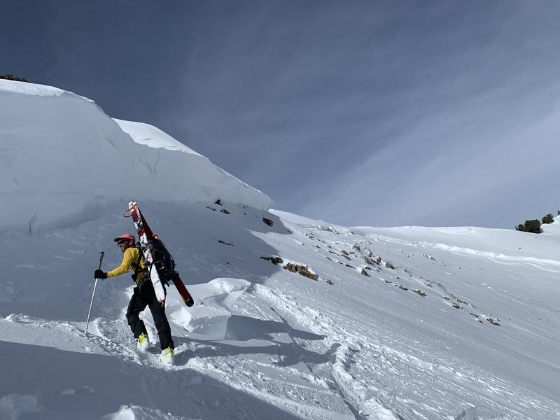
Gobblers Knob into Butler Basin
Elevation
10,200'
Aspect
Northeast
Slope Angle
39°
Trigger
Natural
Avalanche Type
Hard Slab
Avalanche Problem
Persistent Weak Layer
Weak Layer
Facets
Depth
6'
Width
3,500'
Vertical
1,750'
Comments
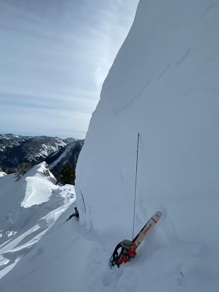
This was one of the biggest avalanches I can remember on this slope, but I've only been around for 16 years in the backcountry. Bruce Tremper said today he's never seen it run that big in his 30-year career. I think this would classify as R4D4. The deepest part of the avalanche was 16 feet deep; however, the average depth across the crown line was closer to 6-8 feet deep. Impressive.
![](https://suds.utahavalanchecenter.org/sites/default/files/styles/observation_image/public/images/avalanches/2022-23/2023-01-12_Butler_Basin-23.jpeg?itok=a5C0P2S-)
![](https://suds.utahavalanchecenter.org/sites/default/files/styles/observation_image/public/images/avalanches/2022-23/2023-01-12_Butler_Basin-56.jpeg?itok=wO0Kx9Ga)
![](https://suds.utahavalanchecenter.org/sites/default/files/styles/observation_image/public/images/avalanches/2022-23/2023-01-12_Butler_Basin-48.jpeg?itok=M500p_od)
![](https://suds.utahavalanchecenter.org/sites/default/files/styles/observation_image/public/images/avalanches/2022-23/2023-01-12_Butler_Basin-55.jpeg?itok=07HXKLTm)
![](https://suds.utahavalanchecenter.org/sites/default/files/styles/observation_image/public/images/avalanches/2022-23/use.jpg?itok=c4Hm9cHb)
![](https://suds.utahavalanchecenter.org/sites/default/files/styles/observation_image/public/images/avalanches/2022-23/Screen%20Shot%202023-01-12%20at%208.05.47%20PM.png?itok=oLre7w1B)
![](https://suds.utahavalanchecenter.org/sites/default/files/styles/observation_image/public/images/avalanches/2022-23/9CA85FAC-F029-47E1-A894-D2F8A1DE69EE.jpeg?itok=6fjZ08FM)
![](https://suds.utahavalanchecenter.org/sites/default/files/styles/observation_image/public/images/avalanches/2022-23/C82B8327-1F05-4600-A53E-74525F40A1EF.jpeg?itok=4wzcRVdz)
![](https://suds.utahavalanchecenter.org/sites/default/files/styles/observation_image/public/images/avalanches/2022-23/504405B8-9388-465E-A9B3-6FDF96DF2C6D.jpeg?itok=ezTxGg5G)
Comments
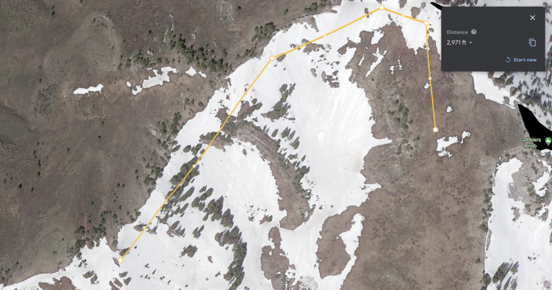
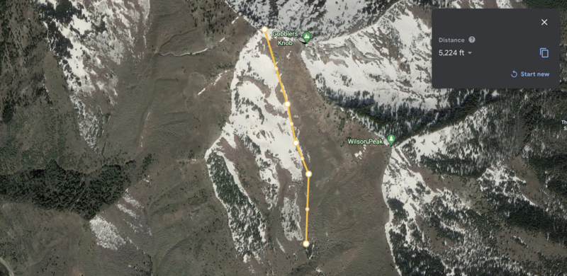
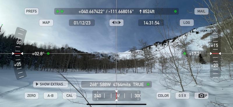
2,971 feet wide is the approximate distance of the crown line. The avalanche descended almost 1,800 vertical feet and ran a distance of 5,224 feet to where the debris stopped. We measured the alpha angle standing on the debris at 17.2°.
![](https://suds.utahavalanchecenter.org/sites/default/files/styles/observation_image/public/images/avalanches/2022-23/Screen%20Shot%202023-01-12%20at%207.56.47%20PM.png?itok=DHrpBgde)
![](https://suds.utahavalanchecenter.org/sites/default/files/styles/observation_image/public/images/avalanches/2022-23/Screen%20Shot%202023-01-12%20at%207.53.24%20PM.png?itok=prlgxptm)
![](https://suds.utahavalanchecenter.org/sites/default/files/styles/observation_image/public/images/avalanches/2022-23/IMG_2179.jpeg?itok=PTfZkR60)
Video
Coordinates